Hollywood Cemetery's Guide to the James River
James River

Welcome to one of the best views of the James River in the City of Richmond

The James River is the oldest feature of Hollywood Cemetery flowing through Richmond on its way from the Appalachian Mountains to Chesapeake Bay. The river can be viewed from many spots in Hollywood Cemetery, but some of the best views are from the Palmer Chapel Mausoleum and Presidents Circle along Riverside Drive.

An Urban Playground

The James River is one of the best-known rivers for urban freshwater recreation in the U.S., serving as a playground for swimmers, rafters, tubers, paddlers, and fish enthusiasts (depending on river levels, which change constantly with rainfall and drought).

Whitewater Icon
Whitewater

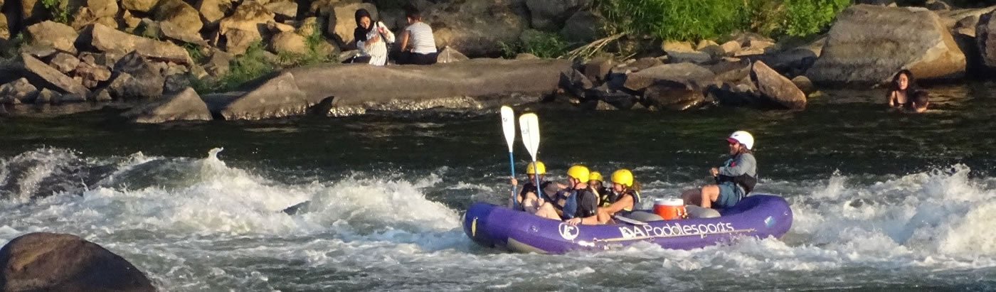
The rapids directly below Hollywood constitute some of the most challenging urban whitewater in the U.S. (offering Class III and Class IV rapids during high flows). The fast-moving water is in an area called the Fall Zone, which stretches about 7 miles, from Bosher Dam at the Huguenot Bridge to the I95 Bridge. The James River drops about 100 feet in the 7-mile stretch, half of which happens in the last mile seen below the cemetery. Beyond the I95 Bridge (to the east), the river flattens and becomes tidal, traveling about 100 miles to Chesapeake Bay.

Fishing Icon
Fishing

Blue catfish is a prized catch in these waters, with giants growing up to 100 pounds. Large-mouth, small-mouth, and striped bass are favorites, as well.

Picnic Icon
River Picnics

Directly across the river is Belle Isle, a preserved city park ideal for riverside walks, and picnics on river rocks and beautiful boulders sculpted by eons of wind and water erosion.

Rocky embankment 
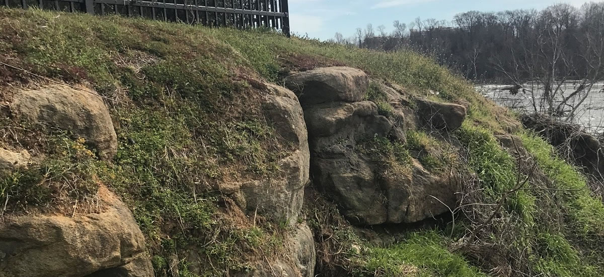
Large outcrops of the ancient Petersburg Granite – some of the largest in Richmond – are most obvious west of the mausoleum.

Millions of Years of Geological History

Geology of the Fall Zone


A river resembling the current James River has been flowing through this area for about 2 million years. Hollywood Cemetery marks the highest present-day top of the ancient river bed! It has taken that long for the water to cut the 100-foot river valley below the cemetery.

As the river flowed from the mountains in western Virginia, it carried eroded sand (from quartz), gravel and clay and formed the land east of the Fall Zone (known as the Coastal Plain). Marine deposits of sand, clay, and shells were also contributed by cyclic advances and retreats of the ocean over millions of years.

The rock beneath your feet is about 330 million years old, and known as the Petersburg Granite. Large outcrops of the granite – some of the largest in Richmond – are most obvious west of the mausoleum. The granite tells a tale of Virginia’s explosive past when the area had very active and large volcanoes and shifting land masses. In fact, the Petersburg Granite is the geologic scar that resulted from a collision and subsequent separation of (what we refer to now as) the African continent with North America!